


Access and Movement
Gleeson Land area plans
Gallagher Developments area plans
Access for vehicles is proposed via two locations on Pewsham Way – one from the roundabout at King Henry’s Drive and the other further west on Pewsham Way. There is also connectivity into the Gleeson scheme and opportunities for future connectivity to the south preserved.
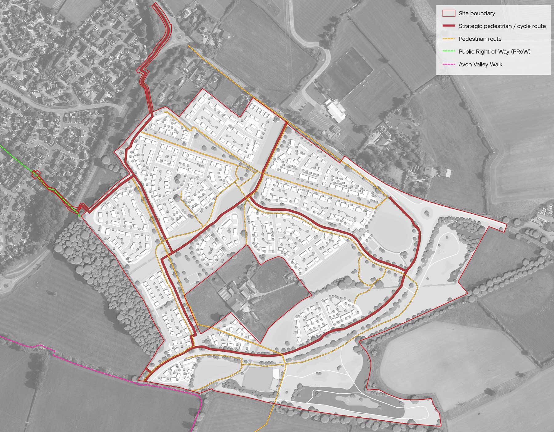
A network of walking and cycling routes will be provided, including the current Avon Valley Walk route and additional cycle routes.
Connectivity to bus stops and other local services and facilities to the west of Pewsham Way will be incorporated, whilst the opportunity to divert existing bus services through the site is also being explored with local bus operators.
General access and movement plans
Public Rights of Way through the sites will be maintained.
There will be a road link between the Gleeson and Gallagher sites, near the potential location for a new school
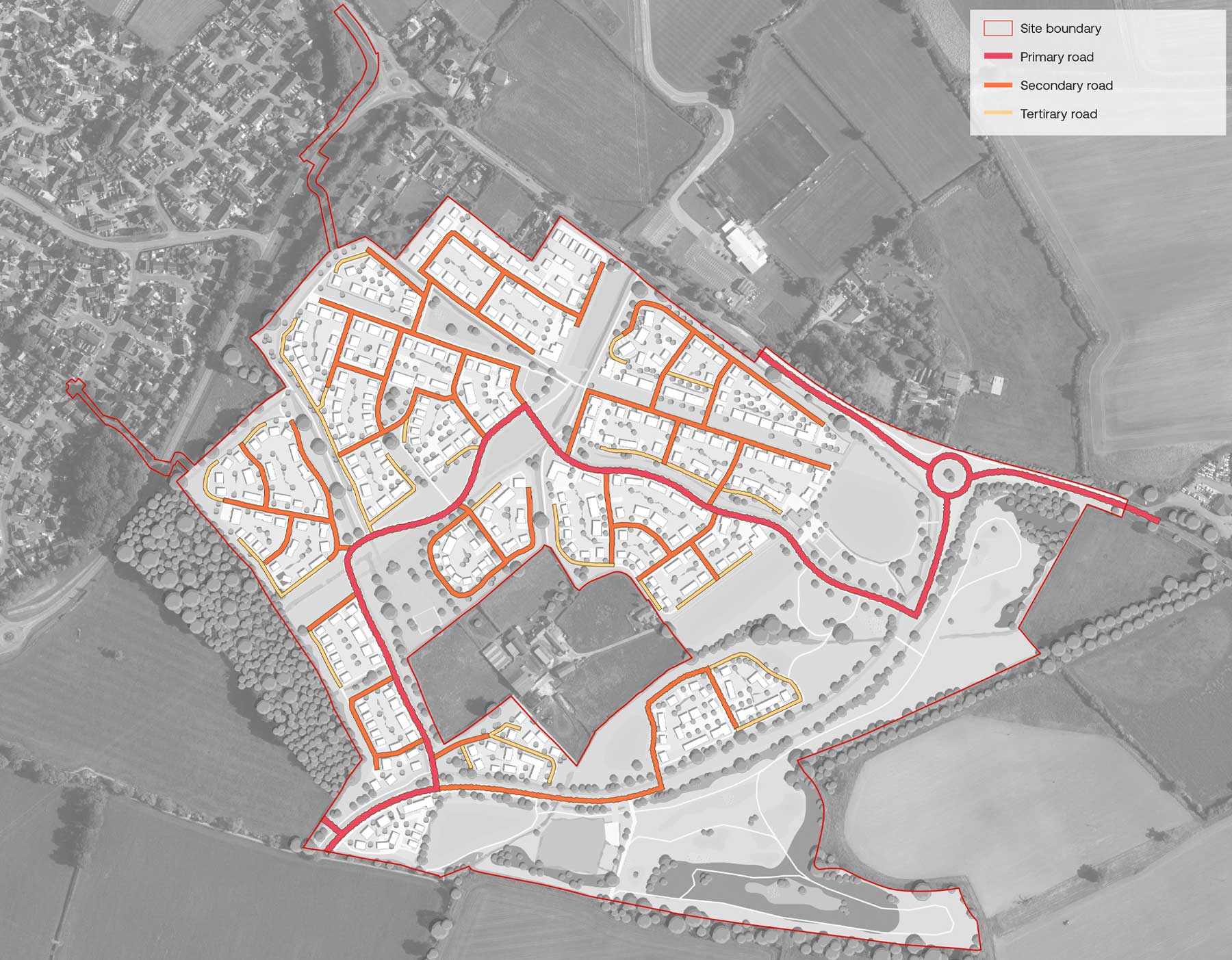
Gleeson Land site
This plan shows the Road Hierarchy – the layout of primary, secondary and tertiary roads within the scheme.
This plan shows the Pedestrian and Cycle access points and routes through the site
Gallagher Developments site
This Access and Land Use plan shows the access points for vehicles, pedestrians and cyclists. It also shows the primary and secondary roads within the site and the Public Rights of Way.
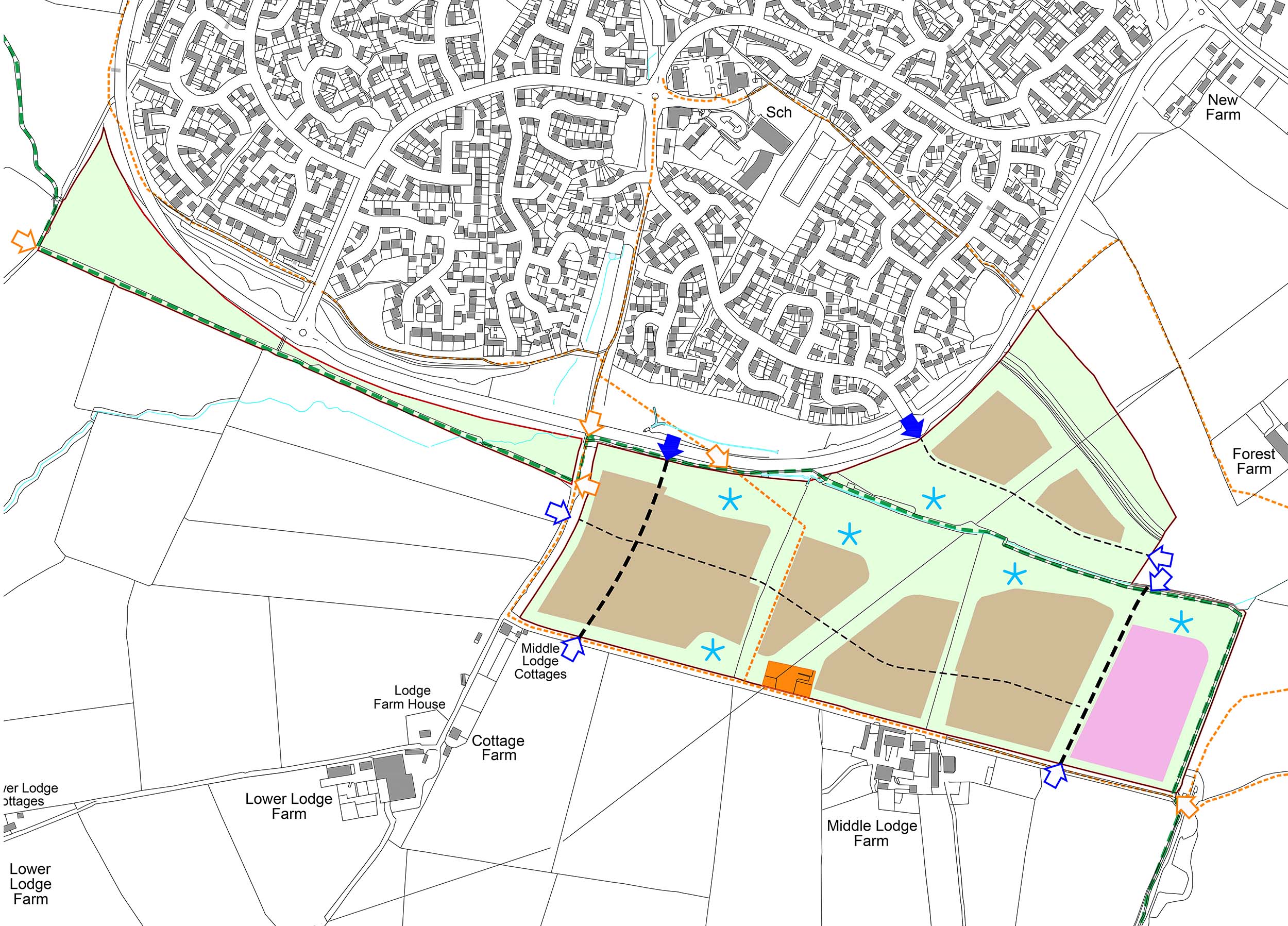

Site Boundary

Residential including roads, POS (incidental green space provision, landscaping) and play

Primary School (2FE)

Green Infrastructure

Area for Demolition

Primary Road / Bus Route (CDR) within a tolerance or +/- 10m

Secondary Streets within a tolerance or +/- 10m

Public Right of Way (PRoW)

Avon Valley Walk

Main Vehicular Access

Vehicular Access from adjacent site / land

Pedestrian and Cycle Access

Indicative location of Attenuation Ponds